

It may not be the best known or most used bridge over the River Hull, but our walkway renovation correspondent Angus Young finds merit in an uncared for achitectural gem.
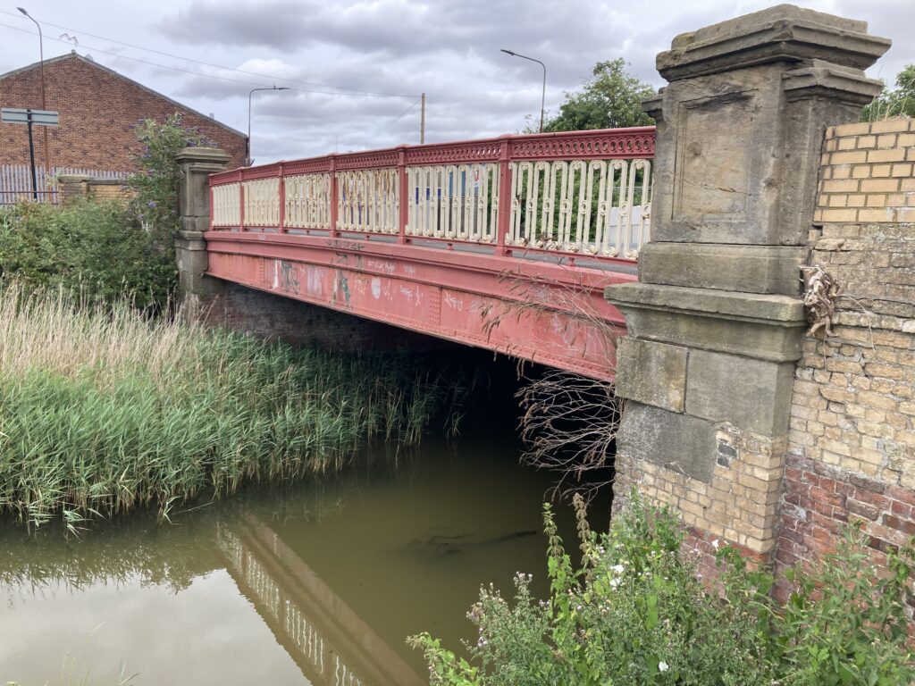
The bridges spanning the River Hull are generally well known features of the city’s landscape. However, those crossing the city’s drains are typically less familiar. Such is the case with the bridge carrying Lockwood Street across Beverley and Barmston Drain. It’s a shame because the bridge itself is a neat and tidy example of sturdy late 19th century urban infrastructure. At least, it used to be neat and tidy until a combination of careless drivers and care-free vandals intervened recently.
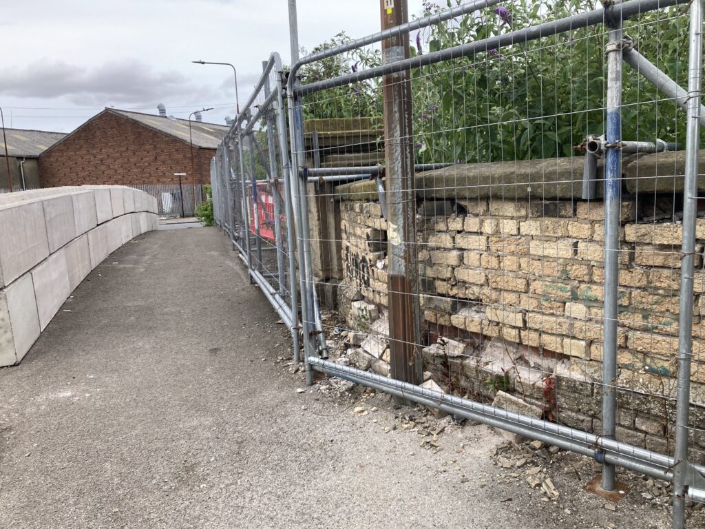
Together, repeated vandalism and vehicle impacts have left part of it in a sorry state. Dislodged bricks, damaged parapets and breakages to a number of cast-iron panels and posts have forced the city council to fence off part of the structure on safety grounds. It’s a sad sight to see because while relatively modest in size and scale, the bridge does still have a certain charm about it. The striking contrast between the yellow and red brickwork and stone detailing might have something to do with it.
Then there’s the ironwork, a throwback to the days when heavy industry surrounded the site and almost certainly provided many of the materials required for its construction. When it was built, the bridge provided a connection between the factories and yards in Wincolmlee next to the River Hull and a large residential area in and around Fountain Road. To an extent, it still does although most of the factories have long gone and a council estate now sits where densely-packed privately-rented terraced housing once stood. Hundreds if not thousands of people would have once walked or cycled across the bridge every day to reach their workplace before making the return journey at night,
The bridge itself is close to the High Flags outfall, where the drain flows into the River Hull. Wooden tidal doors open as the tide goes out to let the drain water reach the river and then closes again as the tide rises, preventing flooding from the Humber.
In the past, keeping the outfall flowing was so important that a river board employee lived close to the site to monitor each tide on a daily basis. There used to be a lot more water in the drain than today mainly because extra water was being discharged into it from the cooling towers of the Sculcoates Power Station. In the 1940s, a pumping station was built in nearby Lincoln Street to keep the water moving even when the tide was in.

Happily, plans are in the pipeline to carry out repairs and restoration work on the bridge in the not too distant future. A recently submitted planning application mapping out the proposed works maps out key elements such as the careful demolition and re-building of the damaged section of brickwork, the replacement of some cast-iron features and the re-positioning of coping stones.
As the bridge has Grade II listed building status, the ultimate sign-off on the scheme going ahead rests with the government although the planning application first has to be agreed by the city council. In a report accompanying the application, consultant bridge engineer Beatrix Hernando says: “While the bridge’s individual components are modest in isolation, collectively they form a coherent and intact historic structure, justifying the asset’s Grade II designation. Works will be undertaken using scaffold access confined within the bridge footprint, avoiding any encroachment into the watercourse. Reusable historic materials, including bricks and stone copings, will be carefully salvaged and reused where feasible to do so. The works will not alter the bridge’s scale, massing, alignment or relationship with its surroundings. All interventions are confined to the parapets and west wing walls, and the reinstated elements will be respectful to the bridge’s heritage.”