
Our Jade helps Charlie from St Mike’s Youth Project outline her favourite things about the place.

Our Jade helps Charlie from St Mike’s Youth Project outline her favourite things about the place.

It may not be the best known or most used bridge over the River Hull, but our walkway renovation correspondent Angus Young finds merit in an uncared for achitectural gem.
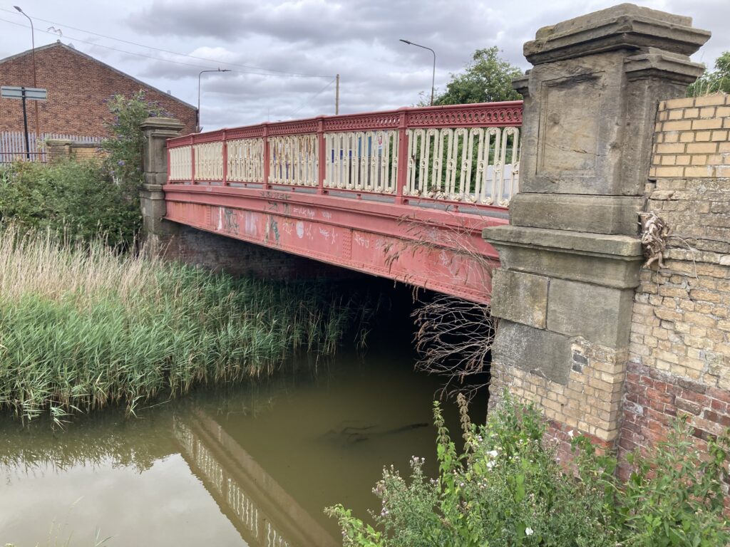
The bridges spanning the River Hull are generally well known features of the city’s landscape. However, those crossing the city’s drains are typically less familiar. Such is the case with the bridge carrying Lockwood Street across Beverley and Barmston Drain. It’s a shame because the bridge itself is a neat and tidy example of sturdy late 19th century urban infrastructure. At least, it used to be neat and tidy until a combination of careless drivers and care-free vandals intervened recently.
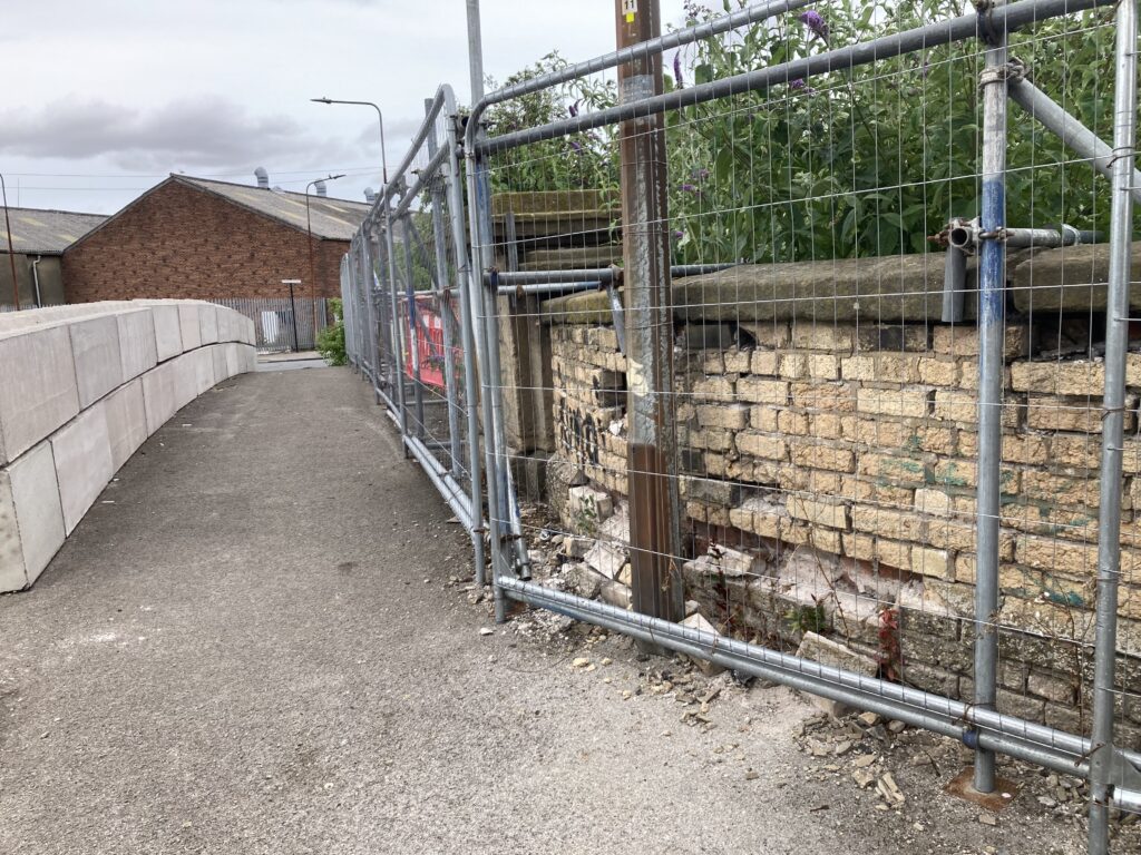
Together, repeated vandalism and vehicle impacts have left part of it in a sorry state. Dislodged bricks, damaged parapets and breakages to a number of cast-iron panels and posts have forced the city council to fence off part of the structure on safety grounds. It’s a sad sight to see because while relatively modest in size and scale, the bridge does still have a certain charm about it. The striking contrast between the yellow and red brickwork and stone detailing might have something to do with it.
Then there’s the ironwork, a throwback to the days when heavy industry surrounded the site and almost certainly provided many of the materials required for its construction. When it was built, the bridge provided a connection between the factories and yards in Wincolmlee next to the River Hull and a large residential area in and around Fountain Road. To an extent, it still does although most of the factories have long gone and a council estate now sits where densely-packed privately-rented terraced housing once stood. Hundreds if not thousands of people would have once walked or cycled across the bridge every day to reach their workplace before making the return journey at night,
The bridge itself is close to the High Flags outfall, where the drain flows into the River Hull. Wooden tidal doors open as the tide goes out to let the drain water reach the river and then closes again as the tide rises, preventing flooding from the Humber.
In the past, keeping the outfall flowing was so important that a river board employee lived close to the site to monitor each tide on a daily basis. There used to be a lot more water in the drain than today mainly because extra water was being discharged into it from the cooling towers of the Sculcoates Power Station. In the 1940s, a pumping station was built in nearby Lincoln Street to keep the water moving even when the tide was in.

Happily, plans are in the pipeline to carry out repairs and restoration work on the bridge in the not too distant future. A recently submitted planning application mapping out the proposed works maps out key elements such as the careful demolition and re-building of the damaged section of brickwork, the replacement of some cast-iron features and the re-positioning of coping stones.
As the bridge has Grade II listed building status, the ultimate sign-off on the scheme going ahead rests with the government although the planning application first has to be agreed by the city council. In a report accompanying the application, consultant bridge engineer Beatrix Hernando says: “While the bridge’s individual components are modest in isolation, collectively they form a coherent and intact historic structure, justifying the asset’s Grade II designation. Works will be undertaken using scaffold access confined within the bridge footprint, avoiding any encroachment into the watercourse. Reusable historic materials, including bricks and stone copings, will be carefully salvaged and reused where feasible to do so. The works will not alter the bridge’s scale, massing, alignment or relationship with its surroundings. All interventions are confined to the parapets and west wing walls, and the reinstated elements will be respectful to the bridge’s heritage.”

Josh from Epic is working on Humber Street Sesh this year and here he is telling us about stuff that he enjoys.

So you’ve caught your child watching the televised traffic. Let Ally-mai recommend matching reading material.

Ian is a former fisherman. We caught up with him at the Hull Fishing Heritage Centre and he told us all about life aboard a steamer.

What do Saigon, The Beatles, poetry and a slum street in Hull have in common? Our conflict photography correspondent Angus Young rediscovers some amazing pictures.

In the summer of England’s World Cup win in 1966, an aspiring Scottish poet became a mature student at Hull University. Douglas Dunn arrived in Hull to study English and, as a fan of Philip Larkin’s poetry, had already managed to have a couple of his own poems published in magazines. Dunn and his wife used their savings to buy a house in a tiny terrace off Terry Street on Beverley Road.
The couple lived there for two years despite their neighbourhood being declared as unfit for human habitation because of the poor condition of the so-called ‘slum’ housing. His experience there inspired his first collection of verse, titled Terry Street. Published in 1969, the book launched him on the road to international acclaim.
Prior to publication, half a dozen of Dunn’s poems appeared in London Magazine accompanied by six photographs of the Terry Street area taken in 1968 by Robert Whitaker. Whitaker was best known for his photographs of The Beatles, including the image used for the cover of the band’s US-only album Yesterday and Today. He would later cover wars in Vietnam and Cambodia and the war of independence in Bangladesh.

Whitaker spent a day in Hull on his commission to illustrate Dunn’s poetry. He said: “Douglas had written his poetry with sympathy, dignity, humour and love, not only about his immediate neighbours but also about his surroundings. His poetry was visual which was a great help for me. It was a simple task for me to record what I saw. I remember making a comment to my girlfriend at the time: ‘What a pleasure to illustrate these simple, precise words’. I spent maybe 45 minutes, three and a half rolls of 35mm 36 exposure film. I was very happy with the day’s work.”
London Magazine used just six of his photographs and his hopes of a book combining all of his images and Dunn’s poems never materialised. “The years passed by and I thought that my Terry Street photographs were doomed to end on a tip, in a plastic bag somewhere in Sussex, after my death.”

In 1994 he received a letter out of the blue from Dr John Osborne, a lecturer at Hull University and co-founder of the Philip Larkin Society, enquiring about the Terry Street photographs. “He believed that I was the cameraman who had photographed the ‘slum’ area called Terry Street.” Whitaker recalled. “In his letter Dr Osborne mentioned that Douglas Dunn had heard a rumour that I had been killed while working as a photographer in Vietnam for Time & Life magazine. I was badly wounded in Vietnam, however, not killed.”
At the time, Dr Osborne was publishing Bete Noire, his own Hull-based poetry magazine and eventually devoted an entire edition to Terry Street, featuring 18 Dunn poems alongside 60 of Whitaker’s photographs. The edition immediately sold out, prompting a later exhibition of both the poems and the photographs at the Ferens Art Gallery.

“Rarely in art history can two distinguished practitioners in entirely different media have brought their skills to bear on a single subject,” wrote Dr Osborne in a special exhibition programme. “Whereas Dunn’s picture of Terry Street is predominantly sombre but relieved by spots of brightness, in Whitaker the proportions are reversed, the vibrancy of the people exceeding the constraints of their impoverishment. In this way, the perspectives of poet and photographer complement one another beautifully and the work of each is enhanced.”
The old terraced housing and the way of life of the people who lived in them captured by Dunn and Whitaker disappeared in the mid-1970s thanks to a council demolition programme. In the 1996 exhibition programme, Whitaker said he was thrilled to see the poetry and images together again. “For me they work together just as well as they did in 1968. Maybe in 200 years they will still tell a story. I still have yearnings for the people who lived in these dignified surroundings. We all have problems, Terry Street was never a ‘slum’ to me.”
Angus Young


Poppy, from Humber Street Gallery, is here representing Humber Street Sesh as she talks us through her favourite things.

Lucy is journalist for the Feminist Urge Collective with an admirably eclectic taste in music.

There’s about to be a great deal of fuss about Bayeaux and Harold and arrow in eyes but what, our medieval invasion correspondent Angus Young asks, has it all got to do with Hull?
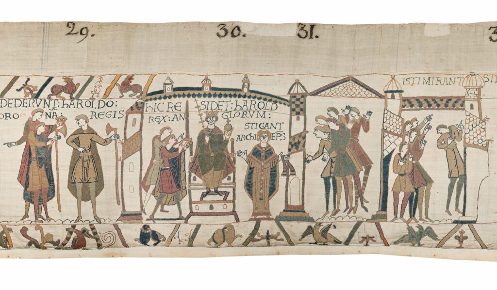
The imminent arrival of the Bayeux Tapestry at the British Museum is expected to trigger renewed interest in all things Norman. The famous 11th century embroidered depiction of the events leading up to Norman Conquest of England in 1066 is thought to have actually been made here rather than France, possibly as a gift to William, the victorious Duke of Normandy. The tapestry has been in France for over 900 years but in September it will go on public display in London as part of a nine-month exhibition at the British Museum.
So what did the Normans do for us here in East Yorkshire?
The village of Stamford Bridge near Pocklington is central to the story of the Conquest as the outcome of a battle there in 1066 heavily influenced the subsequent Norman invasion. In the battle, England’s King Harold defeated a Viking army but his troops were so exhausted that after a long march south they were unable to sustain a fight against William’s Norman forces when they landed in Hastings a month later.
Having killed Harold and conquered England, William divided up the country and put his most trusted men in charge of different parts of it. One of them was Drogo de Beauviiere, an experienced Flemish mercenary soldier who had fought in the Norman invasion force. Drogo’s reward for his service was the granting substantial estates in Lincolnshire, North Yorkshire and a large chunk of land in Holderness, stretching from the Humber estuary to Bridlington.
Bordered by the Humber to the south, the sea to the east, the River Hull flood plain to the west and Earl’s Dyke to the north, the Holderness of Drogo’s day was commonly referred to as being an island. A huge marshland dissected by slow-moving watercourses and hundreds of meres, it was arguably the most remote place in England. A single bridge across the River Hull at Tickton was the only physical connection with the rest of the country until the 18th century.
Drogo built a wooden castle on a raised mound of earth at Skipsea, almost certainly as a strategically-important coastal military staging post. Until recently, it was thought Skipsea was purely a Norman development but archaeologists now believe there was human activity at the site 600 years earlier. Either way, Skipsea remains an important Norman landmark even if only the mound of earth remains.
Much of Drogo’s short history as the first Lord of Holderness is recorded in the Domesday Book, another Norman innovation, and shows how William’s conquest rapidly changed areas like Holderness. Under the overall rule of a lord, the area was divided into three – North, Middle and South Hundreds – with each one responsible for its own system of tax connection, justice and military organisation. In effect, it was the beginnings of local government and Holderness, partly because of its physical remoteness and partly because it was on the frontline of any potential future Viking invasion, became a highly privileged feudal lordship with its own private sheriff and coroner. Drogo and his immediate successors would have spoken Norman-French and this became the language of governance in the region for the next 300 years
The Normans were also keen church builders and St Nicholas Church in North Newbald is said to be the one of the finest complete Norman churches in the country. Built around 1151, the church’s unofficial nickname is The Cathedral of the Wolds. Elsewhere, original Norman features in local churches abound. You can check them out in Wetwang, Flamborough, Beverley (St. Mary’s), Fangfoss and Goodmanham to name but a few.
The Norman-French influence is also reflected in some place names, The famously deserted Medieval village of Wharram Percy was handed to the Norman baron William de Percy in 1086, creating the first chapter of a landowning family dynasty which still continues today with the Duke of Northumberland’s extensive estate which includes Alnwick Castle.
The Bayeux Tapestry itself is another legacy and has inspired two local tapestries made in recent years. Stitched by a team of volunteers using the same techniques as deployed in the Bayeux Tapestry, the Battle of Stanford Bridge Tapestry can be viewed on Tuesdays between 10am and 2pm at the Station Club in Stamford Bridge.
Meanwhile, the Hull Tapestry charting the history of the city is displayed at the Guildhall and can be viewed during working office hours.
Angus Young

Actor Peter McMillan introduces us to his mate Bruce.